
Introducing Pacer’s amazing global Routes! Pacer is creating the largest database of walking paths and trails created by Pacer users just like you. We’ll be highlighting the best Routes in cities throughout the world on our Pacer blogs. You can find routes created by real Pacer’s near you that have been selected for their location, scenery, and walk-friendly features. If you happen to be in Kuala Lumpur, check out one of the great routes below!
Get Pacer! If you don’t have Pacer yet, download Pacer for FREE! (on mobile)
Here’s how to find walking Routes near you:
- On your mobile device: Find your favorite walk in the Pacer App!
- Pacer’s Routes on the web: www.mypacer.com/route
Featured City: Kuala Lumpur, Malaysia (and Selangor State)
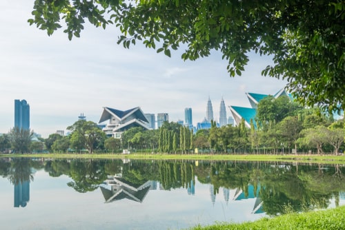
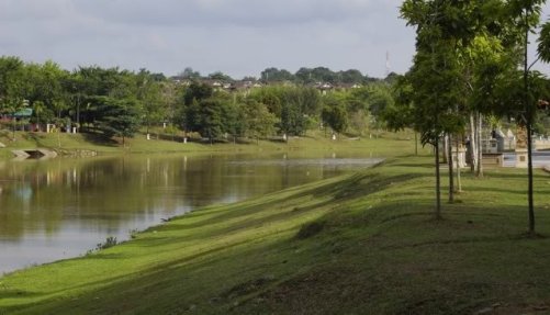
Kuala Lumpur is the capital and largest city in Malaysia, and Selangor is Malaysia’s most populous state. Located in Peninsular Malaysia, Kuala Lumpur (or KL for short) has many beautiful parks, gardens, and lakes that are great for both local residents and visitors to the city. These parks showcase Malaysia’s tropical plant life and biodiversity in the heart of the city. Explore outside of KL in Peninsular Malaysia or travel to East Malaysia on the island of Borneo to visit lush tropical forests, mountains and amazing natural scenery. Today, we’re feating some beautiful, lush tropical routes near KL.
Here’s a list of the top 9 destinations to walk near Kuala Lumpur (including Selangor). Some are well-known parks and walking locations and some are just waiting to be discovered.
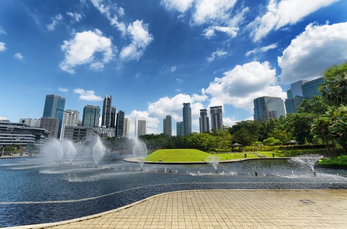
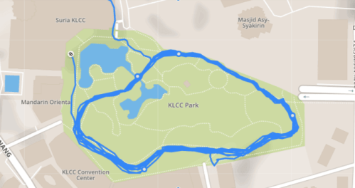
1. KLCC Park

Located in the heart of Kuala Lumpur, KLCC Park is a calm oasis of greenery in the middle of the city. KLCC Park features more than 50 acres of trees and plants as well as fountains and ornamental water features. The center of the park contains a man-made lake with a fountain that can shoot water up to 180 meters into the air. Other features include a 1.3 km rubberized jogging track, rest areas and a playground for children. KLCC park is located next to Suria KLCC mall and the Petronas Towers.
A walk around the edge of the park is about 1.8 km and takes 30-45 minutes.
Features: Kid/Dog-Friendly/Jogging Track
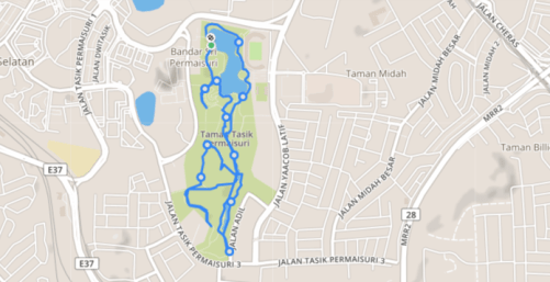
2. Taman Tasik Permaisuri/ Lake Gardens of the Princess

This 40-hectare urban park features a scenic lake with picnic and exercise areas where people practice Tai Chi, yoga, or simply rest and enjoy the area. The park features a football court and playground, as well as walking trails that cut through more forested and natural areas of the park. Taman Tasik Permaisuri is located near Cheras, and can be reached in less than 30 minutes if traveling early in the morning from Petaling Jaya.
Walking a lap around the park covers around 5.3 km, which would take 1.5 to 2 hours.
Features: Kid/Dog-Friendly/Walking Track
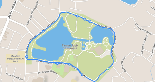
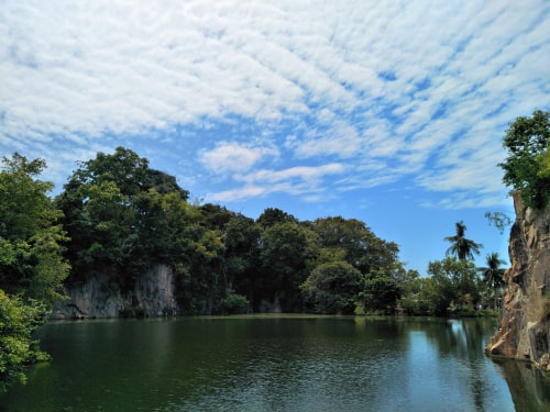
3. Titiwangsa Lake Gardens
Located in northeastern Kuala Lumpur, Taman Tasik Titiwangsa is a 95-hectare recreational park with a 57-hectare lake as its main attraction. Jog or bike one of the park’s walking paths, or take a boat out on the lake. Titiwangsa Lake Gardens is nearby the National Theater and National Gallery of Art for those who want to mix in some sightseeing.
The path around the edge of the park is about 5 km and takes 1.5 to 2 hours.
Features: Tennis Courts/Water Sports/Jogging & Cycling Track/Football Field
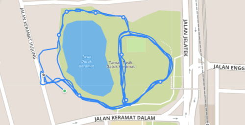
4. Datuk Keramat Lake Gardens – Lake Keramat Park
This park, completed in 2010, includes a lake, sports facilities, and a fitness area. It was designed so that local residents could get out and interact in a natural setting. It is located in Kampung Datuk Keramat – about 7 kilometres from the city centre.
The path around the park is about a 1 km walk that takes 20 to 30 minutes.
Features: Reflexology Lanes/Children’s Playground/Futsal Court
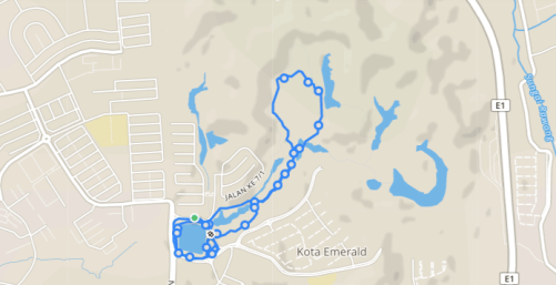
5. Emerald West Park
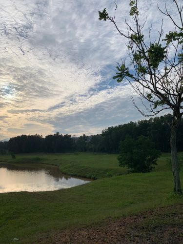
Emerald West is a 1000-acre planned community and housing development in Rawang township featuring lakes, walking trails and green spaces. At the center is a 35-acre Central Park with lakes, boardwalks, sports facilities and over 4km of walking trails. This carefully developed green space makes Emerald West an oasis of natural greenery outside of KL.
A full walk around the park is around 5 km and takes 1.5 to 2 hours.
Features: Kid/Dog-Friendly
6. Subang Ria Park

Subang Ria Park is known as the oldest recreational park in Subang Jaya. This nearly 73-acre park features a lake, walking and jogging track as well as breathtaking views of Subang Jaya.
Walking along the edge of the park is a distance of around 1.5 km and takes 30 to 40 minutes.
Features: Kid/Dog-Friendly

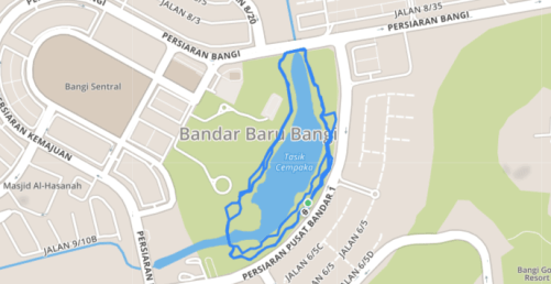
7. Taman Tasik Cempaka
Located in Baru Bangui, Taman Tasik Cempaka features walking tracks, a skate park and playground surrounding a scenic lake. You can rent bikes or a variety of other small vehicles and explore the area, or practice Tai Chi or yoga with the locals.
Walking around this park covers a distance of around 2.5 km which takes 45 to 60 minutes.
Features: Kid/Dog-Friendly/Skate Park/Jogging Track
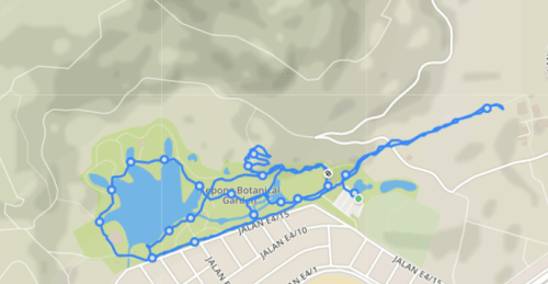
8. The Kepong Botanic Garden
Kepong Botanic Garden displays and conserves a collection of plants native to Malaysia. The center of the park features a large, scenic lake filled with fish surrounded by walking paths. You can walk and observe the carefully landscaped plants or exercise with locals enjoying the beautiful green space.
Walking around the park covers about 4.5 km and takes 1.5 to 2 hours.
Features: Kid/Dog-Friendly/Botanical Garden
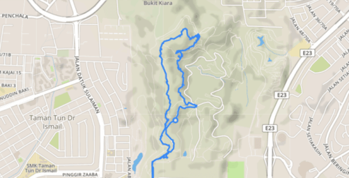
9. Bukit Kiara

Located in the suburbs of Kuala Lumpur, Bukit Kiara is a wooded area considered one of the few remaining “green lungs” of KL. This heavily forested area features paved walking trails as well as more overgrown streams and mountain biking trails for the more adventurous. Some parts of the park are quite hilly if you’re looking for a more intense walk.
Walking the full park route covers around 6.5 km and takes 2 to 2.5 hours.
Important tip: Please don’t feed the monkeys in Bukit Kiara or eat in front of them.
Features: Dog-Friendly/Forest
Find or Create a Route
Find a Route Near You
Pacer gives you multiple ways to find amazing walking Routes like these near you:
- On your mobile device: Find your favorite walk in Pacer!
- On the web: www.mypacer.com/route
Create Route
You can create a Route from a GPS walking track. Just finish your GPS walk, and you’ll be prompted to turn your track into a Route during the process of finalizing your track. You can also click the green Routes button to create your Route. You can also create Routes from older GPS tracks you may have already finished in the past. Just click Routes -> History and then “Create Route” when viewing your old GPS track.
Get Pacer
If you haven’t downloaded the Pacer app yet, download Pacer now for free (on mobile)! You can also check out our website (mobile or desktop) or follow our blog for more great walking and healthy lifestyle tips.
Leave a Reply